


Contours
2010 to 2017
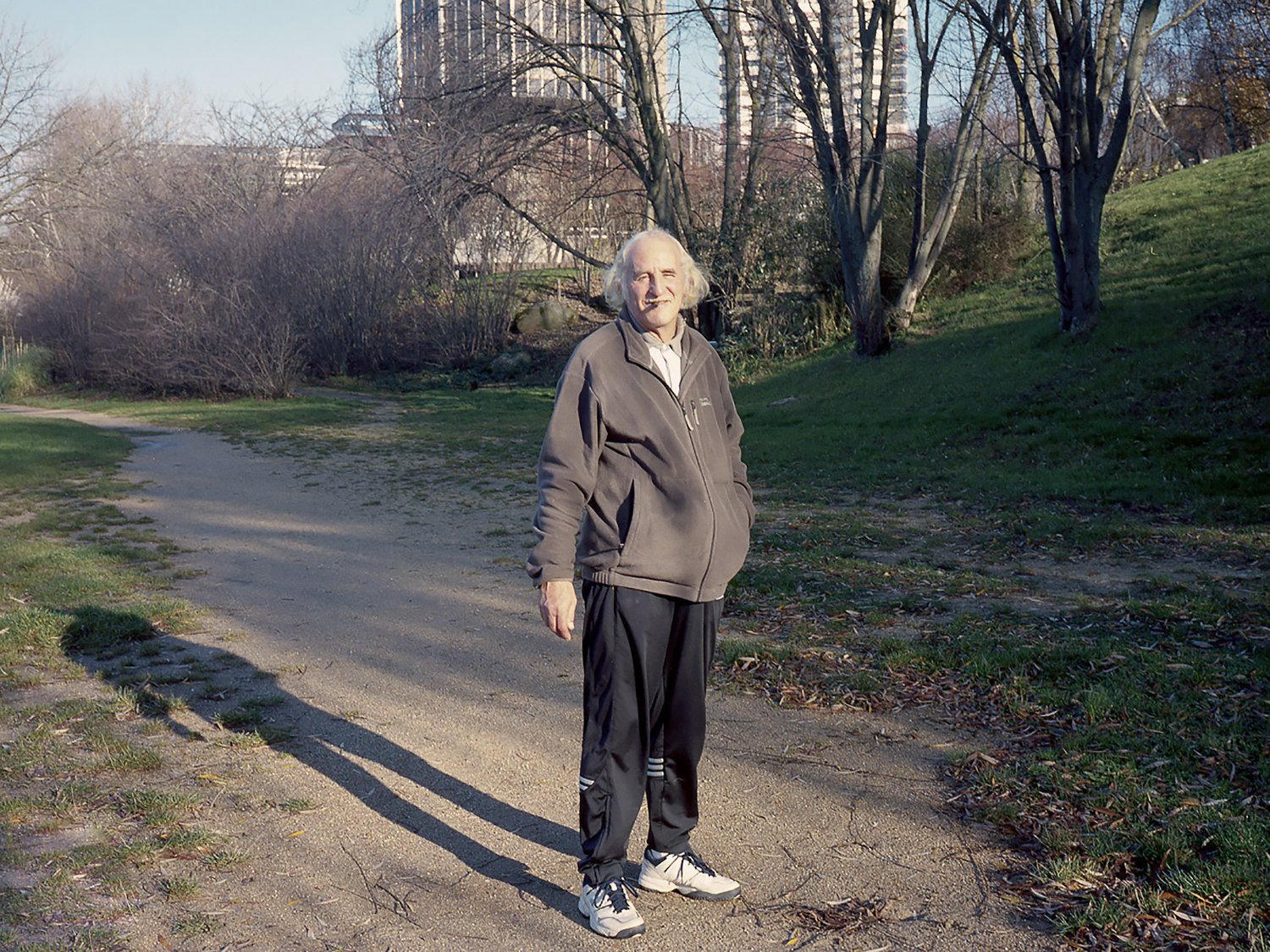
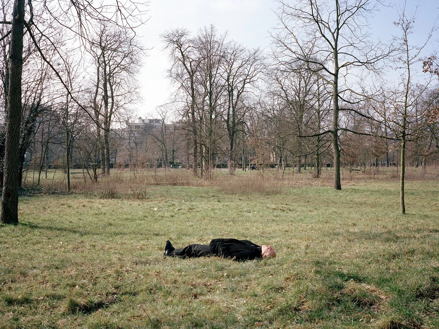
This is a story about a circular land, a 250-metre wide strip that curls around Paris.
Contours tries to interrupt the pattern of sensationalist journalism often used to depict the 'banlieue' of Paris. Drawing on the sense of socio-political hope that was present in the area from the 1920s and which ended with the building of the 'périphérique' motorway in 1958, I am seeking to recreate a fictional green belt around the city. By looking at how a selection of 'natural' spaces are used, I am trying to figure out what remains of the original vision and suggest how the area might look today if things had played out differently. However, the reality is never far from sight.
What began as a nagging sense of curiosity, grew into an affinity with the landscape and an urge to tell a story, which would go beyond the stereotypes sometimes associated with the territory.
La Banlieue de Paris
The following text by Adam Roberts was written in response to a book maquette of Contours produced in 2012.
The city of Paris is like a sliced tree-trunk. From the first ring, a tiny roman camp alongside the Seine, the city has spread outwards in ever-increasing circles. These successive spheres – represented throughout history by walls, barriers and trenches – have left scars on the landscape and tell us of a city eternally caught between expansion and preservation. It is a city that has only known gentle pulses outwards. First the wall of Philippe Auguste, followed in the Middle Ages by those of Charles V and Louis XIII. Later there were the practical barriers and gates of the Fermiers Généraux, and in the 19th century, the defensive Thiers fortifications.
It is this final protective line that now marks the physical limit of Paris, even if today the walls have been replaced by the choking necklace that is the périphérique motorway. Viewed from above, Paris is a reflection of these successive rings, a city of curves and circles, crisscrossed with carefully planned rod-straight Boulevards and Avenues. But what is life like on the other side?
This is a question that has always fascinated the Parisians. The world is comparatively safe and orderly inside the walls, but mysterious beyond the boundaries. In the 18th and early 19th centuries, city-dwellers would gather outside of the Fermiers Généraux barriers, dancing and drinking in taverns that almost touched the walls, but where city laws and taxes didn’t apply. On the hills surrounding this city, in Ménilmontant and Belleville, characters such as Prosper Enfantin set up radical political movements and obscure religious sects.
Later it was the fortifications of the enceinte de Thiers that intrigued. Placed beyond a ring of small suburban towns that had been annexed into the city in 1860, it was a massive – and ultimately useless – belt of stone. Stretching around the city for 33 km, its walls were 3.5 metres thick and 10 metres high, but it is the ‘zone’, 250 meters of land in front of the wall, where no building was permitted, which created the best stories.
This expanse of nothingness naturally attracted those excluded from the city, as well as many curious observers. The photographer Atget, eternal chronicler of the changing city, captured these rootless and itinerant people, their camps and shanty towns, and helped to create the myth of the zonard. His images, in turn, would later inspire the surrealists, who were fascinated by these visions of emptiness and desolation so close to the modern urban environment that Paris had become.
The last remnants of the wall were pulled down in the 1930s, but the barriers still seem to be in place. Instead of creating a protective green scarf for Paris, a huge circular park that would surround the city – a plan that was put forward by some planners – the zone became what it is today, a continuous ring of utilities; schools, sports stadiums, cemeteries, swimming pools, parks and mid-range housing developments, all enclosed by the périphérique motorway.
The barrier today may be porous, more an administrative and psychological limit rather than a stone wall, but it is still visually apparent. Paris simply does not look like the suburban towns that surround it. Cross to the other side of the périphérique motorway and you will immediately know that you have left the city. Walk even further and you will discover myriads of different environments, geographically close to Paris, but completely detached from its rituals and uniform appearance.
A walk to the west will be dominated by the massive business district of La Défense. Serving this, a blanket of wealthy suburbs housing the workers in these financial factories, places such as Suresnes and Saint Cloud, Chatou and Carrières, that have become typified by modern interchangeable apartment blocks and sculpted parks.
Walk north and east and you will find liminal landscapes. Pockets of industry, 6-lane motorways, warehouses and Chinese-owned cash and carry establishments, with unplanned suburban sprawl washing around their feet. Here there is still old stock low-rise housing and the parks – at Tremblay or Créteil for example – seem wilder. Though carefully managed, with artificial undulations and lakes, they give the impression of being a natural environment. Without any great history or identity, the land surrounding Paris was the perfect blank page, a place where new architectures and community structures could be tested.
First to exploit this were the hygienist movement, following the ideas of Englishman Ebenezer Howard, who pushed for the creation of new cité jardin communities, where choking city workers could be surrounded by air and greenery. Some of these projects, in Stains and Asnières for example, still stand today.
From the 1920s to the 1970s, huge multi-floor developments were built, most loosely based on Le Corbusier’s Unité d’Habitation model. They were designed to be self-sufficient and all-inclusive spaces, and sprang up further and further away from the infrastructure of the city.
These developments were initially attractive, bringing in workers from Paris, as well as immigrants from other cities and countries. Creating a ring of their own around the outer edges of Paris, these areas, with Communist-run town councils and a desire to invent a new way of living, became known as the Banlieue rouge.
The dream did not last for long though. The environment gave the impression of rurality, but their physical distance from wealth-creating Paris, the lack of transport links and the death of local services on site eventually turned these developments into ghettos, but it has not signalled the end of the dream.
More recently, encouraged by the development of the rapid RER train system, there has been a move towards the creation of satellite towns, micro-communities that will perhaps one day grow their own rings. These places, Marne-la-Vallée and the Disney development to the east, Saint Quentin en Yvelines and Cergy to the west, define the true outer limits of the influence of Paris, and appear as mirages of concrete beyond a landscape that is still rural.
Neither rich nor poor, these are places of necessity. They are not dream locations for those living there, with little in the way of history, culture or identity, but are merely best-fit solutions. Paris is a place of intense centralisation, but conversely a place of exclusion. Work remains centred around the first rings of the city, but the population can no longer afford to live there. They have been pushed out towards the external limits of its territory.
Wherever the future contours of Paris lay, there will always be something on the outside, in-between worlds of alternative possibilities. Though Paris is largely fossilised in grey stone, the suburbs, eternally reinvented, still offer the chance for something new. Landscapes change subtly, creating previously unseen environments, which in turn attract those who want to capture this on film or in writing. Their creations will create myths that will inspire the future realities of this world.
Adam Roberts, 2012, Invisible Paris